


Aircraft, power, payloads, and support.
Talk with a specialist about a field-ready package built around your operation.
Plan your system
Payloads, accessories, field equipment, and system upgrades for agriculture and enterprise drone...
DJI
Couldn't load pickup availability
The DJI Zenmuse L3 is DJI’s next-generation aerial LiDAR solution built for high-precision mapping, surveying, and industrial inspection. Integrating a long-range LiDAR module, dual 100MP mapping cameras, and a high-accuracy IMU system, the L3 enables professionals to capture dense point clouds and high-resolution imagery in a single flight—dramatically improving efficiency and data reliability.

Equipped with a 1535 nm laser, the Zenmuse L3 delivers a maximum detection range of up to 950 meters (10% reflectivity), capturing fine details such as power lines and vegetation structures with exceptional accuracy.
Featuring dual 4/3 CMOS RGB cameras with mechanical shutters, the L3 captures ultra-high-resolution imagery with up to 3 cm GSD, ensuring accurate colorized point clouds and detailed orthophotos.
Supports up to 2 million points per second and multiple return signals, enabling strong ground penetration in dense vegetation and complex urban environments.

Cover up to 100 km² per day, significantly reducing field time and labor costs for large-scale projects.
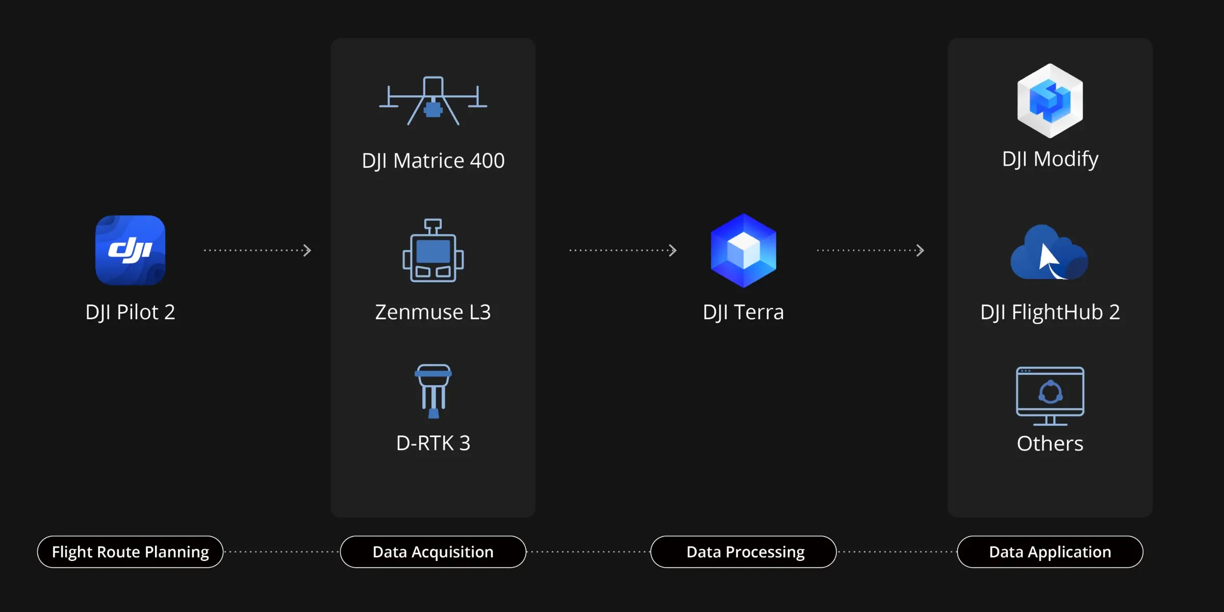
Zenmuse L3 seamlessly integrates with DJI's ecosystem to deliver an end-to-end mapping solution. From data acquisition and processing to application, this unified workflow is simpler to operate and easier to master than traditional multi-platform setups, helping users efficiently complete a wide range of mapping tasks.
Delivers a complete workflow covering data capture, processing, and application.
Fully compatible with:


Product details
Talk with a specialist about a field-ready package built around your operation.
Plan your systemPreserve working capital while investing in the equipment and support your team needs.
Financing optionsPair your purchase with training, service, genuine parts, and expert technical support.
Service & support